Midway through August my friend Ian invited me along for a big day trip to Widgeon Peak to do some exploring and trail work. The plan was to check out different routes up to Widgeon Peak, explore Widgeon Peaks's summit, and do trail maintenance work along the Burke Ridge trail and the Burke-Widgeon Connector trail.
The day before had nice weather, so I went for a 7 hour hike and bike trip to North Vancouver and climbed the 3 Needles peaks, where I enjoyed some fun scrambling and got some nice photos. This probably wasn't the ideal decision for my body, but I figured a hiking double header would be a fun challenge.
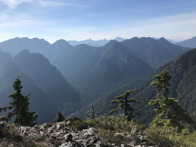
Looking west from the South Needle at Lynn Creek with Crown MTN above.
Looking northwest towards the Howe Sound Crest Trail.
Looking north at Coliseum and Burwell Peaks.
Another shot north at Coliseum and Burwell Peaks.
Looking west at Lynn Creek from the cliffy Middle Needle.
A view to the west from the North Needle.
That night I quickly packed my gear and tried to rest well, and I woke up early the next day at around 4:30am. The plan was to for me to meet Ian and another trail volunteer named Dean near the Old Lodge site on Burke Ridge around 7am and start hiking up the ridge. To follow COVID-19 protocol we wouldn't share vehicles. The road up the mountain is rough and I don't have a suspension 4x4 vehicle, so I'd be racing Dean and Ian's trucks up the mountain on my mountain bike.
My mom kindly dropped me off at the gun club at the bottom of Burke Mountain at 5:45am to give me a head start, and I pedalled my hiking gear up the steep gravel road in the dark. Ian and Dean passed me in their trucks quite low down on the mountain, and Ian helped me out by taking my heavy pack. They had passed me far lower than expected. I rode pretty hard so they wouldn't be waiting too long for me up higher. Eventually I met them near the Lodge Site, and we started hiking up the ridge.
We chatted most of the way along Burke Ridge, and after many ups and downs found ourselves at the saddle between Burke North Summit and Widgeon Peak where the trail hiking would end and the route-finding would begin. After several awkward side-hills and bush swimming sections, we were below the summit block of Widgeon Peak. The first time I was on Widgeon Peak about a year ago, I went straight up a steep chute to the top of the summit on the climber's left, and this was a bit sketchy. When Ian had climbed Widgeon Peak before, he had taken a different route along a bench to the climber's right, and this sounded a bit nicer. We looked for this bench, but had trouble finding it as Ian's memory of the route was a bit fuzzy. We ended up in some tricky terrain and after pulling ourselves up some steep bushy slopes, we popped out between the east and west summits of Widgeon Peak. None of us had been to the east summit before, so we decided to check that out first. We dropped into a gully and had to do a few ups and downs, but we eventually got ourselves to the top of the east summit block. The summit itself was expansive, and the views were great. There were lots of different spots to explore on the summit. I ran around with my camera and took some photos of different views from the summit.

Ian and Dean heading towards the east summit beside a small pond.
A nice view of Pitt Lake from the east summit.
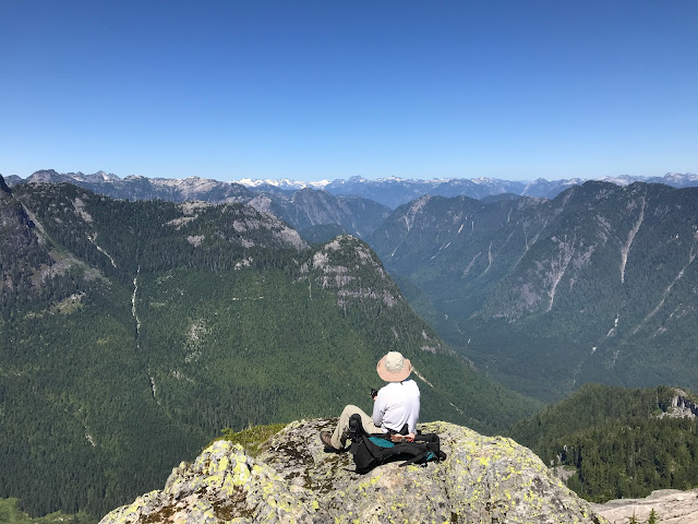
Looking down into the Widgeon Valley from the east summit.
Looking northeast from the bushy summit.
The view of Pitt Meadows from the east summit.
Looking at bumpy terrain to the west from the east summit (west summit is at the top left).
Ian on a rock looking down towards the Widgeon Valley.
After hitting all of the main view spots on the east summit, we retraced our route back towards the west summit. After a bit of steep downhill and steep uphill, we were on the west summit. We all pulled out our lunches and enjoyed the scenery.
The view north towards Gabbro Peak and the 5 fingers region.
Another view down into the Widgeon Valley.
Looking back over at the east summit.
Another view to the north.
The east summit with Pitt Lake behind it.
Another view down at Pitt Meadows.
Looking to the northeast at Gloomy Ridge.
We relaxed on the summit for about a half hour before starting back down. I was running very low on water and was rationing it carefully. I had brought 1.5L which is usually enough, but it was a very hot day and we had been working hard for a while, and I had also put in a big effort climbing up the mountain on my bike earlier in the day, so I'd sweated a bit more than normal.
We retraced our route back down to the Burke-Widgeon saddle. We found the bench on the summit block we had been looking for on the way up, which made the summit block descent smoother than the climb up. Eventually when a trail is built to the summit, it should follow that bench, since it is the safest way up. We marked it and I got the track on my GPS for next time.
Once we got back onto the trail, we began doing a bit of trail work. Ian went ahead with his chainsaw and cut out most of the windfall over the trail, and me and Dean followed up with clippers and cut back bush and cleared debris from the trail. We plugged along this way for about 45 minutes when I decided it would be best for me to head home as I had run out of water and was getting pretty dehydrated, and let the other 2 continue trail work since they had more energy and water than me.
I went ahead along the trail as efficiently as I could go. My mouth and throat was getting pretty dry, which was annoying. I discovered an effective technique for preventing this dryness, which was to keep my mouth shut and only breath out of my nose.
After a few ups and downs and getting disoriented in a few spots, I was at Ted Kay Lake ready to drink a lot of water. I sat down at a soft spot lakeside and drank about 2L of water using my filter. Eventually my thirst was quenched I continued along the last portion of the hike to my bike. I hopped on my bike, and enjoyed the cruise down the mountain before making one last effort up the hill to my house. The trip ended up being 15 hours, which is the longest trip of my summer. For Ian and Dean who continued the trail work for another couple of hours, it ended up being a massive 17 hour day on the mountain.
When I got home, my legs were as sore as they have ever been. After about 22 hours of activity in the last 48 hours, every muscle in my body felt stiff. I crawled into bed that night and had a great night's sleep after a satisfying day of exploring new terrain and making trail improvements. I have to thank Ian and Dean for making this a fun trip, and I look forward making more trail improvements and exploring in that area in the future!


Comments
Post a Comment